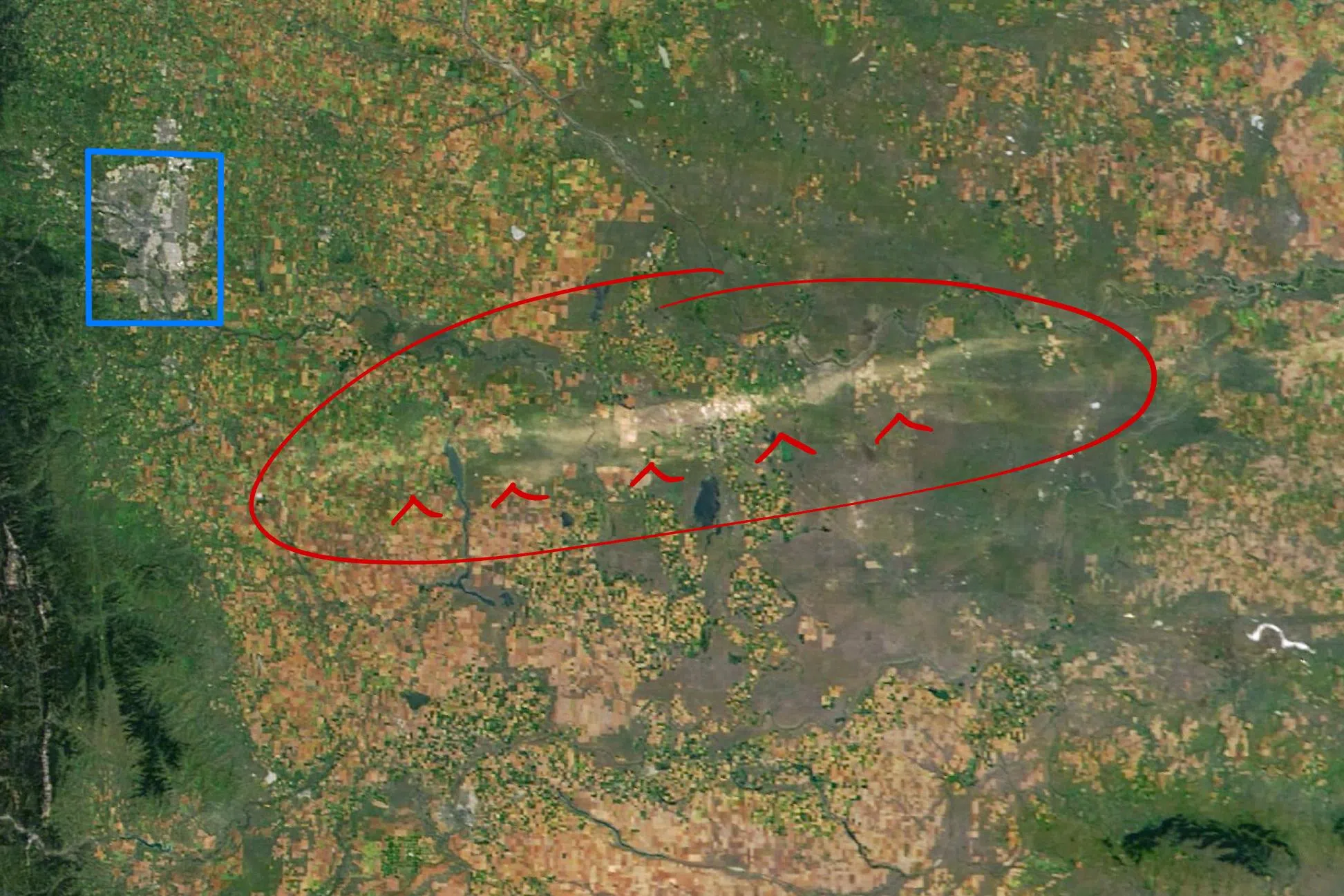
Satellite image with Calgary in Blue and the Hail Scar in Red from the NASA website
On August 20, 2025, a severe “supercell storm” with 150 km/h winds and hail swept across southern Alberta, damaging around 425,000 acres of crops, ranchlands, and homes.
The most intense zone left a prominent “hail scar” visible from space, as seen on these satellite images published by NASA.
The scar measures approximately 15 kilometres wide and 200 kilometres long, starting near Vulcan and centred north of Brooks.
The storm caused extensive destruction, including the complete shredding of corn stalks, overturned irrigation systems, and severe damage to home siding.
Ranchland and other crops were also badly damaged, which may lead to years of reduced grazing and production capacity.
The storm also resulted in numerous insurance claims, both for homeowners and farmers in the area, with residents reporting that this was the worst storm they had ever experienced.
Comments